BLACK LAKE, Mich. — The Petermans wanted flood insurance when they bought their retirement home on Black Lake 14 years ago. They were told none was available. John Solum bought a 1940s-era cabin here and was told his family wasn’t in a flood zone.
Then came this spring. Historic floods across northern Michigan.
Water swamped homes. Ice on Black Lake broke apart decks and crashed through windows. Solum, who lived through floods in Houston, said he’d never seen anything like it.
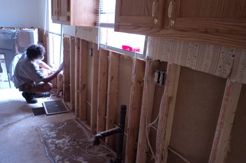
Knee-high water forced his family to rip out flooring, drywall, furniture, bedding and appliances. Across Michigan, thousands had no financial protection.
Record April rains fell on top of record March snowfall. Worse, many had no idea they were at risk, despite years of increasingly heavy precipitation. Dozens of counties declared states of emergency.
This is not a fluke. It’s the result of a system that is, by many measures, not keeping up. The Federal Emergency Management Agency makes the maps that tell people whether they live in a flood plain and must buy insurance.
Those maps also help communities plan. But in less-populated areas, including some Michigan counties that got hammered, FEMA hasn’t developed maps at all.
Black Lake sits in two counties — Cheboygan and another. Cheboygan has a FEMA flood map from 2012. That’s a decade and more of climate change ago.
The government’s mapping method is arguably outdated. It does not account for actual risks as climate change increases the odds of more extreme weather.
Experts say what happened in Michigan exposes vulnerabilities across the country. Flood plain maps don’t cover all areas. People who think they are safe often are not.
Consider the numbers. Record March snowfall. Then record April rain.
The ground was already saturated. Water had nowhere to go.
Dams were pushed to the brink of failure. Roadways washed out. In some places, for the first time anyone could remember, water poured into homes that had stood dry for decades.
The Petermans and Solum found out the hard way that the map said one thing but reality said another. The Petermans tried to buy insurance.
They couldn’t. Solum was told he didn’t need it. Both were wrong.
Both paid the price. FEMA’s maps are supposed to help. But they are not everywhere.
They are not always current. And they don’t factor in a changing climate.
Heavy rain used to be rare. Now it’s routine. The maps haven’t caught up.
Neither have the people who trust them. In northern Michigan, that trust is gone.
Solum and his neighbors are tearing out their homes. They are drying out what they can. They are throwing away what they can’t.
They are asking why nobody told them this could happen. The answer is complicated. The maps are old.
The climate is new. The gap between them is where people fall through.
Dozens of counties are under emergency. Thousands are without coverage. The Petermans and Solum represent a much larger story.
Across the country, people live in places that could flood but are not on a flood map. They have no insurance.
They have no plan. They have no idea.